East Side Chicago: At the Crossroads of Industry and Nature
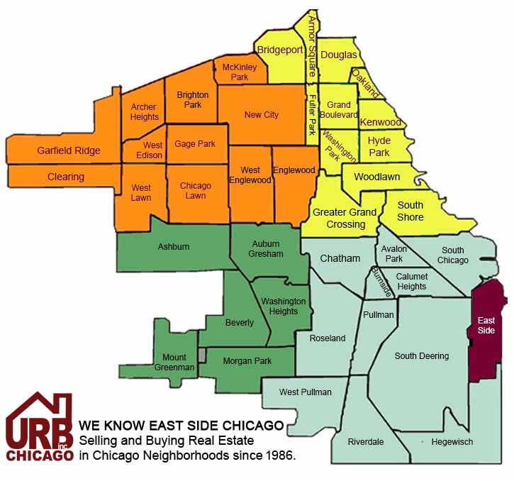
Located on the southeastern edge of Chicago, East Side is a neighborhood that perfectly illustrates the balance between industrial prowess and natural beauty.
As one of the city’s 77 official community areas, East Side is bordered by the Indiana state line to the east, the Calumet River to the west, the Calumet River and the Calumet Harbor to the north, and 126th Street to the south.
Industrial Backbone
East Side has a long history of industrial development. The neighborhood’s proximity to the Calumet River and Lake Michigan made it an ideal location for shipping and industry which is a significant part of the neighborhood’s identity.
Natural Beauty and Recreation
Despite its industrial roots, East Side is also known for its natural landscapes and recreational opportunities. The neighborhood is home to several parks and green spaces, providing residents with ample opportunities for outdoor activities. Calumet Park is a standout feature, offering a beach, picnic areas, sports fields, and a historic fieldhouse. The park’s location along Lake Michigan makes it a popular destination for both locals and visitors.
Big Marsh Park is another notable natural area in East Side. Once a neglected industrial site, Big Marsh has been transformed into a 278-acre park that includes hiking and biking trails, bird-watching areas, and a bike park. The park’s restoration is a testament to the community’s commitment to environmental sustainability and outdoor recreation.
Community and Culture
East Side is a diverse and vibrant community with a rich cultural heritage and commercial corridors, such as East 106th Street, are bustling with activity, offering a variety of dining and shopping options.
Educational Opportunities
East Side offers a range of educational opportunities for residents. The neighborhood is served by several public and private schools, providing quality education options for families. In addition to primary and secondary schools, East Side is home to the Chicago Academy of Arts, which offers specialized programs in the visual and performing arts.
Future of the East Side
East Side is a neighborhood that embodies the resilience and diversity of Chicago. Its unique blend of industrial history, natural beauty, and vibrant community life make it a dynamic and evolving area. Initiatives to attract new businesses and promote environmental sustainability are helping to shape the future of East Side to offer a rich and rewarding experience for residents and visitors alike.

